Ski areas from Japan’s past 過去の日本のスキー場を懐かしむ
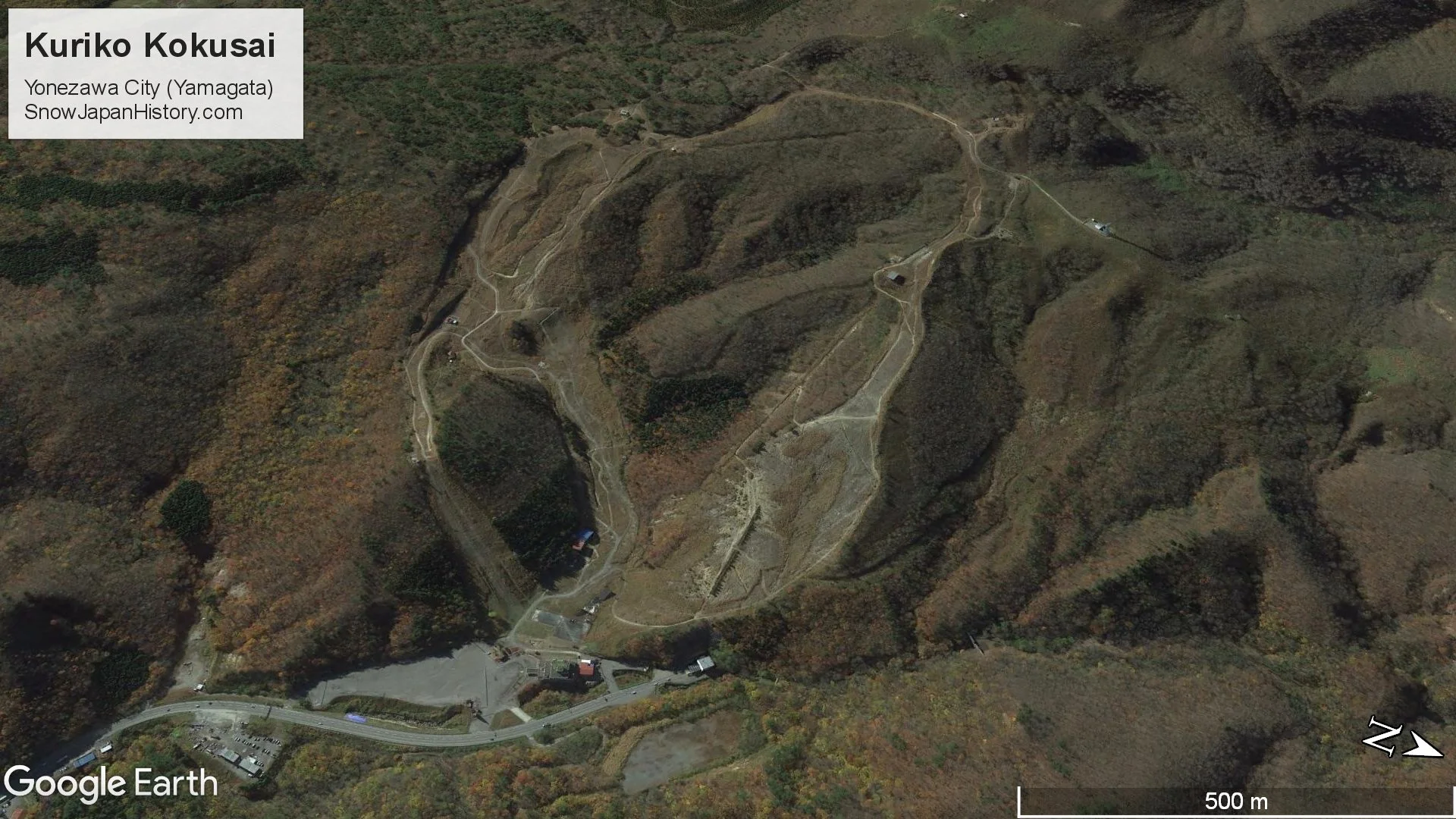
Kuriko Kokusai
Yonezawa City, Yamagata Prefecture
栗子国際スキー場 山形県米沢市
Kuriko Kokusai was a ski area located in the eastern region of Yonezawa City, close to the Yamagata and Fukushima Prefecture border. It is around 16km to the south west of Yonezawa City and 25km to the west of central Fukushima City. Kuriko Kokusai struggled in later years due to low snowfall and then a decrease in the number of visitors following the earthquake and Fukushima Daiichi nuclear plant incident in March 2011. The lifts and facilities remain in place and the official status of Kuriko Kokusai is 'closed'.

| Opened 開設 |
1967 | |
| Closed 閉設 |
Last open in 2016 | |
| Base elevation 標高最低 |
350m | |
| Top elevation 標高最高 |
950m | |
| Vertical 標高差 |
600m | |
| Steepest slope 最大斜度 |
33° | |
| Number of Courses コース本数 |
6 | |
| Longest course 最長滑走距離 |
2,000m | |
| Skill level 初級・中級・上級 |
20% beginner 60% intermediate 20% advanced |
|
| Ski / board スキー・ボード |
65% / 35% [2001] | |
| Ski lifts リフト本数 |
5 lifts | |
| Quad | 850m | |
| Pair | 400m | |
| Pair | 627m | |
| Single | 625m | |
| Single | 650m | |
| Facilities mostly remain in place | ||
| Night skiing ナイター設備 |
There was night skiing every day | |
Photographs
Taken in June 2022
写真撮影:2022年6月


Further Information
|
Google Earth
Google Street View
Google Maps
Located by the side of Route 13 on the Yamagata Prefecture and Fukushima Prefecture border
About 17km from Yonezawa Chuo IC exit of the Tohoku Chuo Expressway
About 19.5km from the Fukushima Iizaka IC exit of the Tohoku Expressway
About 2.5km from Itaya Station on the Ou Honsen line
About 16.5km from Yonezawa Station and 25km from Fukushima Station on the Yamagata Shinkansen line
東北中央自動車道 米沢中央ICから的17km
東北自動車道 福島飯坂ICから的19.5km
奥羽本線 板谷駅から的2.5km
山形新幹線 米沢駅から的16.5km 福島駅から的25km
All currently operating ski areas in Yamagata Prefecture (SnowJapan.com)
This page was created in May 2020
Last updated on 13th July 2022
2020年5月 作成 2022年7月13日 更新